Activities
Nestled in the foothills below the majestic Sierra Nevada. Visalia is the Gateway of Sequoia and Kings Canyon National Parks.
The city's charm and strong community welcome visitors year-round for an experience filled with live entertainment, stunning art, rich history, and world-class restaurants.
Savor the city's fresh farm to fork cuisine at one of many sidewalk cafes, take a stroll in the quaint Downtown district, tour the richest agricultural region in the United States, browse boutiques and antiques, having a hiking, biking, rafting, or snowshoeing adventure, and relax with a glass of local wine. With beautiful weather, friendly people, and hundreds of explorations, all we need now is the explorer.
The Sequoia National Forest
The Sequoia National Forest, named for the world's largest trees, celebrates the greatest concentration of giant sequoia groves in the world. Protected within the Giant Sequoia National Monument, these groves and the areas around them are managed by the U.S. Forest Service for today and for future generations.
The landscape is as spectacular as the trees!
Soaring granite monoliths, glacier-carved canyons, limestone caves, roaring world-class whitewater, and scenic lakes and reservoirs await your discovery at the Sierra Nevada's southern reach. Elevations range from 1,000 feet in the lower canyons to peaks over 12,000 feet on the crest of the Sierra, providing some of the best panoramic views in a dramatic range of settings in the entire west!
Special Places
Over the years, Congress has designated areas unique for the special characteristics and the opportunities they offer, such as Wilderness and Wild and Scenic Rivers. In addition, Congress has passed laws protecting historical and archaeological sites. Some special places have been established by Executive Order and Presidential Proclamation, such as the Giant Sequoia National Monument. Other places have no formal designation, but are special places nonetheless!
Giant Sequoia National Monument
Established in April 2000 and encompassing 353,000 acres, the Giant Sequoia National Monument is home to 33 groves of giant sequoia ( Sequoiadendron giganteum ) - the world's largest tree.
Wild and Scenic Rivers and Lakes
The National Wild and Scenic Rivers System was created by Congress in 1968 to preserve certain rivers with outstanding natural, cultural, and recreational values in a free-flowing condition for the enjoyment of present and future generations. The Act is notable for safeguarding the special character of these rivers. It encourages river management that crosses political boundaries and promotes public participation in developing goals for river protection.
Wilderness
Wilderness is an indispensable part of American history and one that is uniquely an American idea. The Wilderness Act of 1964 formally acknowledged, through congressional legislation, the lasting benefits of these wild places to the human spirit and aimed to protect the balance and harmony of nature.
Scenic Byways and Highways
Scenic Byways connect the public to destinations and special places. These designated roads traverse some of our country's most unique landscapes, noteworthy for their scenery and natural and cultural features. They are the gateways to access attractions such as hiking trails, overlooks, historic sites, waterfalls, Wilderness Areas, and Wild and Scenic Rivers.
High Country Areas
The high country of the Sequoia National Forest are areas located in higher elevations, typically above 5,000 feet above sea level. These areas will usually have deep snow in the winter and are much cooler than lower elevation areas, while in the summer months these areas are filled with lush green meadows, vibrant wildflowers and provide a cool welcoming escape from the valley heat.
Water Activities
White Water paradise awaits you! Our wild and scenic rivers offer miles of excitement for rafts and kayaks. Commercial raft companies have trips available from easy to advanced. Canoes and inner tubes are not recommended. Also check out Lake Isabella for fishing and boating. Be safe! Where its rock'n: Kern River – North and South Forks, Kings River – Main and South Forks, Tule River.Mountain Biking
Ready to get your pedals turning? Then come enjoy your National Forest land from the seat of a bicycle! Any official trail on Forest Service land allows bicycles, with the exceptions of trails in designated Wilderness and the Pacific Crest Trail. There are literally hundreds of miles of trails and roads to explore in the Sequoia National Forest, and a bike is a great way to see much of them. Many trails are steep or rocky and may be for advanced riders only, we recommend you contact us before choosing a trail to ride.
Mountain Biking Areas
- Kern Plateau
- Little Cannell Trail
- Trout Creek Trail
- Hume Lake Ranger District
- Hume Lake Day Use Area
- Hume Lake Trailhead
- Kern River Ranger District
- Badger Gap Trail
- Portuguese Trail
- Unal Interpretive Trail
- Western Divide Ranger District
- Baker Point Trail
- Deer Creek Trail
- Deer Trail
- Dunn Fire Trail
- Fish Creek Trail (WD)
- Freeman Creek Trail
- Frog Meadow Trail
- Hossack Trail
- Jordan Lookout Trail
- Lewis Camp Trail
- Lewis Camp Trailhead
- Lion Ridge Trail
- Marshall Meadow Trail
- Needles Lookout Trail
Rock Climbing
Part of the fun of climbing is dicovering the secret routes or places no one has been before. with over 1 million acres to explore, you better believe there are some granite secrets locked away within the Sequoia National Forest and the Giant Sequoia National Monument. Well known areas for climbing include the Needles and the Domeland Wilderness , specifically Church Dome.
Fishing
Sparkling mountain rivers flow year round through the Sequoia National Forest, with the most water coming down during the spring snow-melt. These rivers provide anglers with a chance to not only catch fish, but also to escape the busy day-to-day world with some well-deserved recreation.
If moving water isn't your style, Lake Isabella and Hume Lake are great places to try your luck. Lake Isabella also has several Marinas and boat launches to help you get out to where the fish are. Hope you catch the big one!
Hiking
Be prepared to be overwhelmed with the choices you have when it comes to hiking in the Sequoia National Forest! But don't be alarmed, you can plan your perfect trip using the information here on this website, or by calling one of our offices for further information. Hiking in the Sequoia NF is what you want to make of it. We encourage all hikers to evaluate their skill level, choose a trail and conditions that are appropriate, plan what you take with you carefully, and let people know where you are going and when you'll be back.
There are an incredible amount of day-hikes available that all offer different views, from forests, to deserts, to granite peaks. Hiking is the way to explore the forest, and is allowed anywhere within the forest.
Advanced hikers and backpackers can find the challenges they seek as well. The Pacific Crest Trail runs through several sections of the Sequoia NF. The six designated Wilderness areas also give backpackers a chance to get away from it all and return to nature for a few days!
Caving
Explore a magnificent cavern with many varieties of natural speleotherms, including rare “shield” formations. 45-minute tour available daily and suitable for the entire family.
Sequoia and Kings Canyon National Parks
A Land of Giants
This landscape testifies to nature's size, beauty, and diversity - huge mountains, rugged foothills, deep canyons, vast caverns, and the world's largest trees.
Sequoia and Kings Canyon National Parks lie side-by-side in the southern Sierra Nevada, east of the San Joaquin Valley. Visitor activities vary by season and elevation
(1,370 to 14,494 feet).
ome Opening/Closing Dates for Services and Facilities May Change- Check Back for Updates.
Some of the opening/closing dates for facilities and visitor services in the parks may change due to weather and/or other circumstances. Please call 559-565-3341 BEFORE you plan to visit.
The parks are open 24 hours a day, 365 days a year, weather permitting. Our highest visitation is in July and August. Campsites may be difficult to obtain on summer weekends and holidays, as well as off-season holidays.
Because of the extreme elevation range in the parks, weather conditions vary greatly from area to area and day to day. Please see the links below for more information on the season that corresponds to the time when you will visit the parks.
Campsite Reservations
There are 14 campgrounds in the parks, the majority of which are first-come, first-served . Lodgepole , Dorst and certain group campgrounds are open to reservations. Read more about campgrounds..
Directions
Please read important park alerts by clicking the red tab above before you come to the parks. Please note: GPS and route-finding units do not give accurate directions in this area. Double-check your route using the park map and road signs. Do not rely on GPS devices. You can visit Sequoia and Kings Canyon National Parks all year. Two highways enter the parks. Inside the parks' boundaries both become the Generals Highway, often referred to as "the road between the parks." Highway 180 east from Fresno enters the Grant Grove area of Kings Canyon National Park, then continues 30 miles east to the Cedar Grove area. Highway 180 ends 6 miles east of Cedar Grove. Highway 198 enters Sequoia National Park from the southwest via Three Rivers. There are no roads that cross the mountains west-to-east through the parks. NEW! Vehicles Entering/Exiting Sequoia National Park via Generals Highway (the Main Road through the Parks) and Hwy 198 Vehicles longer than the recommendations listed below will likely cross the double yellow line. Drivers will be held responsible for any hazardous conditions caused by their actions. Follow the recommendations below for your safety and the safety of others:
The section of the Generals Highway leading to and from the "Big Trees" in Giant Forest was built from 1921-1926. As a result, the road was not constructed to accommodate longer vehicles. WEATHER-RELATED DETOURS MAY BE NECESSARY! For more information on road construction, road status, and length limits and advisories, visit the Road Conditions page or call (559) 565-3341 (press 1, 1, 1). |


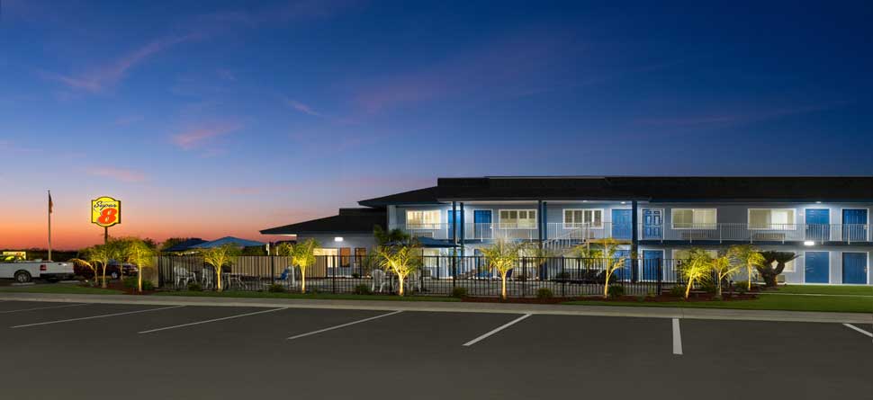
Super 8 Olive Tree Lindsay
(559) 562-5188
390 North Hwy 65
Lindsay, CA 93247
Web Accessible Site

Lindsay
Links
- Travel Directory
- Home
- Rooms
- Amenities
- Reservations Online
- Directions Super 8 Olive Tree Lindsay Lindsay California
- Photo Gallery
- Contact Super 8 Olive Tree Lindsay Lindsay California CA
- Privacy Policy
Designed by Myeres.com and One Stop PMS.com